Geological Mapping
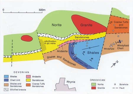
Geological mapping is a vital step in understanding the earth’s surface and subsurface. Our team prepares detailed maps that clearly illustrate lithology, stratigraphy, and structural features across an area. These maps not only reveal the distribution of rock types but also help locate mineral resources, groundwater aquifers, and suitable sites for engineering projects. With accurate geological maps, you can build a strong foundation for exploration, development, and long-term planning.
Geological Cross Sections
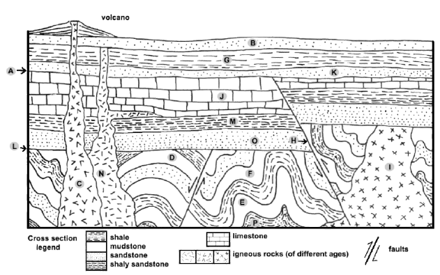
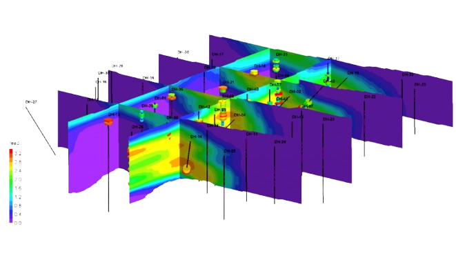
To complement surface mapping, we create geological cross sections that show the arrangement of rock layers below the ground. These visual representations highlight fold patterns, fault systems, and structural complexities. By studying these sections, geologists can predict how formations continue at depth, identify possible ore deposits, and guide drilling or excavation programs.
On-Surface Reconnaissance
Every project begins with systematic reconnaissance of the area. During this stage, our geologists record observations from rock outcrops, mineralized zones, and visible structural features. This fieldwork provides early insights into the geological framework and directs more detailed mapping and exploration activities.
Structural Demarcation
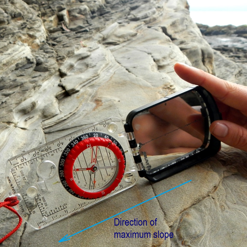
Tectonic features such as folds, faults, joints, and lineaments control many natural processes, from mineralization to groundwater flow. Identifying and mapping these structures is essential for mining exploration, hydrogeological assessments, and civil construction planning. With precise structural demarcation, we help clients understand the stability and potential of their project areas.
Lithology Studies
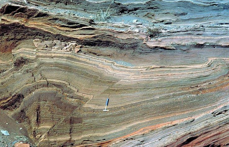
Understanding rock composition is a key part of geological mapping. Through lithological studies, we identify rock types, analyze mineral content, and document textures. These details provide important information for classifying formations, assessing mineral potential, and determining safe locations for infrastructure or water development projects.
Stratigraphic Analysis
The study of stratigraphy reveals the sequence, age, and correlation of rock layers. By analyzing sedimentary sequences and stratigraphic columns, we reconstruct the geological history of an area. This process also helps in identifying resource-rich horizons, predicting basin evolution, and understanding long-term geological changes.
Why Choose Our Geological Services?
Our geological services combine expertise, precision, and modern techniques to deliver reliable results. We bring together skilled geologists, advanced mapping tools, and a commitment to accuracy. With us, you gain:
✔️Expert interpretation of field and subsurface data
✔️Clear and dependable maps for exploration, mining, groundwater, and engineering projects
✔️Integrated solutions from initial reconnaissance to comprehensive reporting
You can also learn about international best practices by reviewing the USGS Geological Mapping Program.
Frequently Asked Questions (FAQ)
1. What is geological mapping and why is it important?
Geological mapping is the process of documenting rock types, structures, and stratigraphy in a given area. It is important because it helps identify mineral resources, groundwater aquifers, and safe sites for engineering projects.
2. How do geological cross sections support exploration?
Cross sections provide a visual view of subsurface rock layers. They help predict the continuation of formations, locate ore deposits, and guide drilling or excavation.
3. What is the difference between lithology and stratigraphy?
Lithology focuses on the physical and mineralogical properties of rocks, while stratigraphy studies the sequence, age, and correlation of rock layers. Both are essential for resource evaluation and geological history reconstruction.
4. How does structural mapping benefit engineering and mining?
By identifying folds, faults, joints, and lineaments, structural mapping reveals zones of mineralization, groundwater flow, and potential geohazards. This information is crucial for safe mining, construction, and groundwater development.
5. What tools and methods are used in geological mapping?
Modern geological mapping combines traditional fieldwork with advanced tools such as GIS, satellite imagery, and geophysical surveys, ensuring precise results.
